Sensing the world, changing the future.
The AxelGlobe Earth Observation platform will contribute to solving business issues and creating new value and markets in various industrial fields based on observation data from our constellation of satellites.
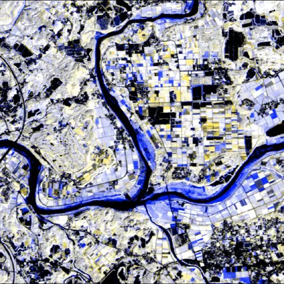
In addition to being able to observe any location on the planet without being restricted by geography, it is also possible to visualize qualitative and quantitative changes that were previously difficult to monitor and to efficiently grasp the situation.
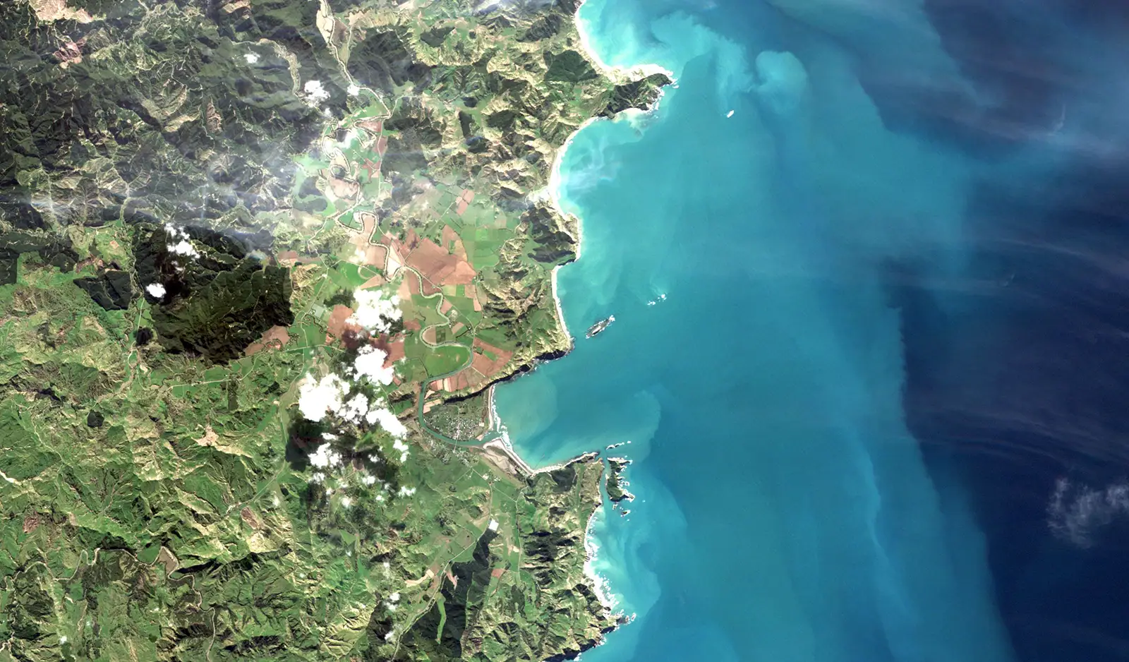
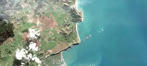
GRUS-1 satellites, each with a swath width of 55 km or more and a ground resolution of 2.5 m, enable wide-area, high-definition, and high-frequency observations that are difficult to obtain from the ground.
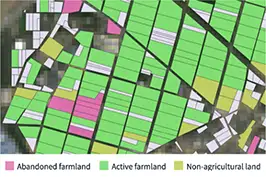
Satellite observation contributes to business by visualizing a variety of insights, such as temporal changes over a wide area, conditions in remote and dangerous areas where it is difficult to dispatch people, and vegetation conditions that cannot be captured by visible light.
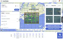
Browsing, searching, refining, and requesting downloads of satellite data can all be done with ease on the web platform.
In addition to our Tasking API, you can now request GRUS observations with even greater ease, right from your web browser.
AxelGlobe allows you to perform Earth Observations by specifying observation conditions such as areas and frequency. Users can obtain the satellite data they really need, not just archived data.

By collecting Earth Observation imagery from our GRUS-1 constellation, we can provide a variety of insights that help businesses improve efficiency and solve problems.
Customers can quickly and easily monitor the conditions and changes even in areas that are difficult for people to access due to cost, distance, or environmental constraints.
Satellites can also be used for wide-area observations, and monitoring of specific areas.
Here is an example of how we assessed a flood disaster situation in Kumamoto Prefecture, Japan in 2022. AxelGlobe conducted emergency observations after the flooding. The estimated inundation area was visualized by comparing satellite data before and after the disaster and analyzing it using NDWI*.
Using satellite imagery in such a way is useful for quickly assessing damage and formulating reconstruction plans, which are difficult to do with ground-based surveys alone.
*NDWI: Normalized Difference Water Index
Before Flooding
After Flooding
Visualize inundated areas in blue
AxelGlobe's satellite data solutions contribute to the business of a wide range of customers worldwide.


Introduction to the general flow of Earth Observation and satellite data acquisition using AxelGlobe
We offer a variety of plans tailored to meet your needs
| Service | Needs | Content |
|---|---|---|
| AxelGlobe Archive | Using imagery of a specific place, date, and time | Search and Purchase the imagery from the past archive |
| AxelGlobe Tasking | Checking the situation of a specific area | Observation of user-selected area |
| AxelGlobe Monitoring | Regular monitoring of specific areas | Observations of user-selected area/frequency |
| AxelGlobe Mosaic | Checking the situation of a wide area | Observations of user-selected area/frequency and provision of cloud-free images |
| Analysis and Consulting | Solving business issues through advanced analysis using satellite data | Individual consultation service by our staff |
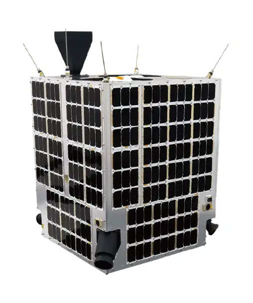
A 100 kg class microsatellite operated by Axelspace, equipped with two optical telescopes to provide a wide observation range and high resolution. Panchromatic, RGB, Red-Edge, and Near-Infrared bands provide information on vegetation and water distribution that is difficult to obtain with visible light alone.
| Range | Longest collection length: 1,000 km Swath: 55 km |
|---|---|
| Resolution | Ground Resolution: 2.5 m |
| Frequency | Revisit Period: 2-3 days |
| Number of Satellites | 5 | ||||||||||||||
|---|---|---|---|---|---|---|---|---|---|---|---|---|---|---|---|
| Design life | Over 5 years | ||||||||||||||
| Orbital altitude | 585 km, Sun-synchronous sub-recurrent orbit | ||||||||||||||
| Equator passage time | 10:40-11:00 (local time) | ||||||||||||||
| Spectral band |
| ||||||||||||||
| Ground resolution *at nadir | Panchromatic: 2.5 m Multispectral: 5.0 m | ||||||||||||||
| Swath *at nadir | 55 km | ||||||||||||||
| Longest collection length | 1,000 km | ||||||||||||||
| Sensor bit depth | 12 bits |
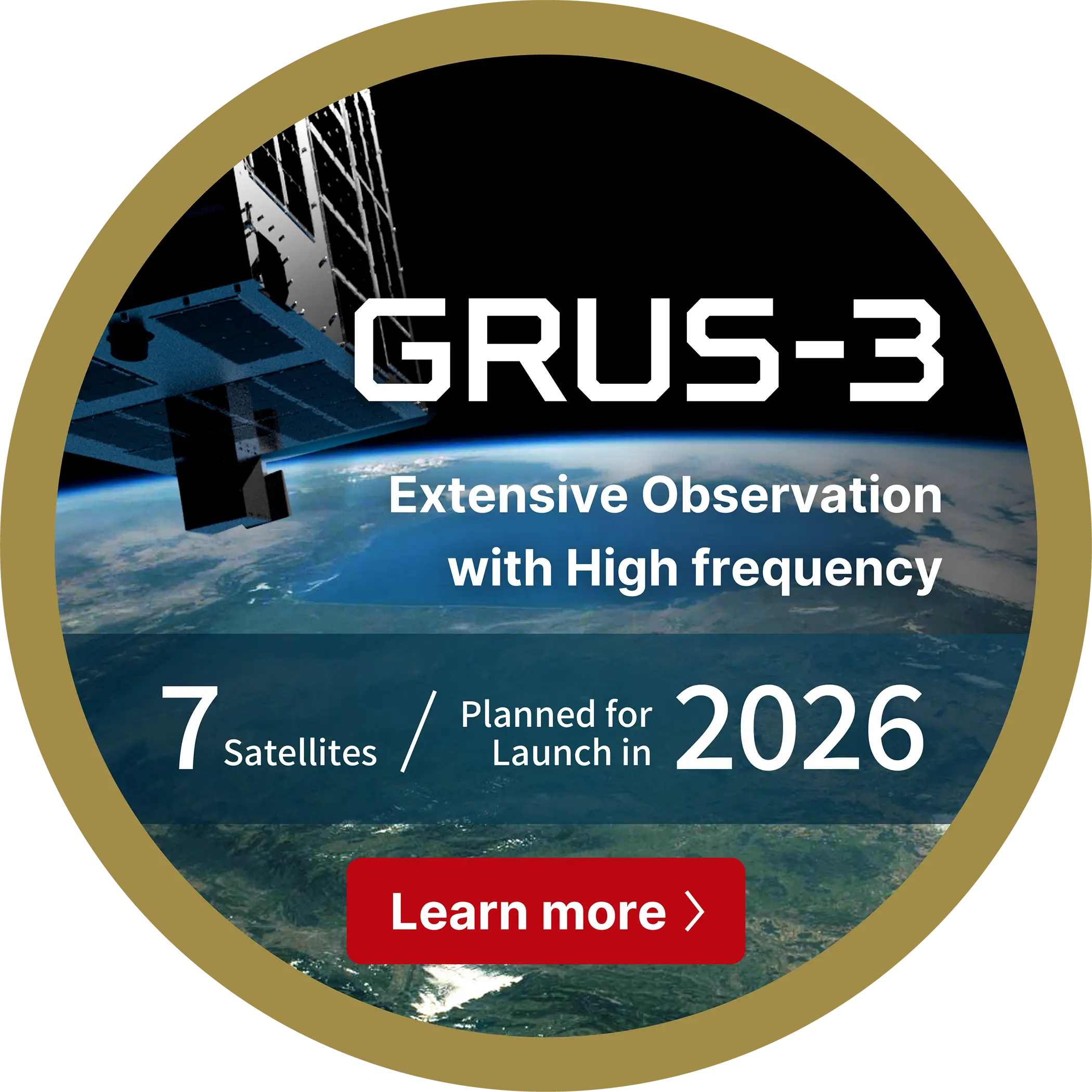
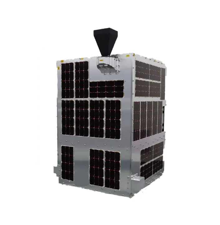
The addition of these new seven satellites to our constellation will enable extensive coverage, higher frequency observations, and swift delivery of clearer images. The newly added Coastal Blue Band sensor will be also useful for observing coastal seabed topography and algae beds that absorb carbon dioxide in the water.
| Ground resolution | 2.2 m | |||||||
|---|---|---|---|---|---|---|---|---|
| Orbital altitude | 585 km, Sun-synchronous sub-recurrent orbit | |||||||
| Swath | 28.3 km | |||||||
| Longest collection length | 1356 km | |||||||
| Spectral band |
| |||||||
| Weight | Aprox. 150 kg | |||||||
| Size | Width 96 cm, Depth 78 cm, Height 126 cm |
Improved Earth observation performance will enable the provision of enhanced business insights.


To take high-quality images of satellites in space from orbit, HEO requires a large network of satellites that have high-resolution sensors onboard. Partnering with AxelGlobe allows HEO to be able to quickly image satellites in space and apply our analytics to solve challenges in space.
AxelGlobe’s team of innovators were the first of our providers to implement high off nadir angles to their satellites, which allowed HEO to expand our coverage of in-space objects and increase the quality and number of images we take per month.
Often, satellite imagery companies can either do high resolution over small areas or medium resolution over very large areas. This is where the AxelGlobe service is different. We had several projects where we needed very large areas captured (15,000km2), at high resolution, with regular cadence.
We were very happy with the quality of the AxelGlobe data, as it included a Red-Edge band for our agricultural application. API integration meant seamless delivery to our users through our software platform. Our customers were also happy with the turnaround times of the data, allowing them to use it for real time decision making.
Please refer to AxelGlobe image specifications
No expertise is required. Customers can easily search and download imagery by operating the browser on the AxelGlobe Web platform.
Yes, Customers can request Earth Observation in the areas and frequency of their choice without being restricted by geographical factors.
Please contact us through our contact form. We can offer the services and prices to meet your needs.
No. Companies in various industrial fields widely use it.
Axelspace provides insights that are difficult to obtain from the ground through extensive, high-frequency, high-precision Earth Observation and contributes to the efficiency of operations and rapid decision-making.
Yes, we also offer AxelLiner, which provides one-stop services for satellite manufacturing and operation.